Groundwater-Mapping Helicopter to Make Low-Level Flights over Regions in Southwestern New Mexico
Sep 30, 2026
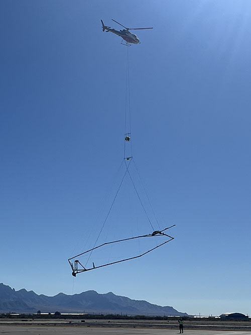
SOCORRO, N.M. – For the next six months, residents of Catron, Doña Ana, Grant, Luna, Sierra, and Socorro Counties may notice a low-flying helicopter towing a large hexagonal frame. This unique equipment is part of a project by the New Mexico Bureau of Geology and Mineral Resources to further map groundwater aquifers and subsurface geology in the area.
“We are continuing and improving our ability to map New Mexico’s aquifers for better water management and planning, especially for future generations,” says Stacy Timmons, Associate Director for Hydrogeology Programs at the Bureau of Geology. “We’re able to cover broad regions much more efficiently using these techniques that help us see deeper into the subsurface over very large areas.”
The New Mexico Bureau of Geology, working with Aqua Geo Frameworks LLC, has coordinated
the flights to improve the understanding of the area’s groundwater. The project’s
ultimate objective is to collect information that will enable the Bureau of Geology
to develop detailed maps of aquifers to
support more informed management and planning for New Mexico’s water resources.
The scientific equipment hangs about 100 feet below the helicopter and transmits and
receives noninvasive electromagnetic signals to help map geologic structures and groundwater
resources down to 1,200 feet below the land surface. The helicopter will be flown
by pilots specially trained for low-level flying, and their flight path is designed
to get the best available underground data. Since data can only be collected over
open spaces, no data collection will occur over residential areas, livestock feeding
operations, or other buildings. The project is not tied to any specific water development
project but is focused on scientific data collection.
More information, including maps of survey areas and a video describing previous airborne
electromagnetic surveys in New Mexico, can be found at
https://geoinfo.nmt.edu/geoscience/research/home.cfml?id=149
The New Mexico Bureau of Geology and Mineral Resources is a nonregulatory research and service division of New Mexico Tech and serves as the state’s geological survey. Bureau of Geology scientists study and provide information about the state’s natural geologic resources and hazards.