Bureau of Geology lands substantial increase in STATEMAP funding from USGS
August 4, 2020
Mapping Program new round of funding of almost $400,000 will cover new maps of Northwest N.M.
Socorro, N.M. - The New Mexico Bureau of Geology’s Geologic Mapping Program received a cumulative award worth $399,242 from the United State Geological Survey’s National Cooperative Geologic Mapping Program, a significant increase over previous years’ awards.
The increase is in part the result of the new STATEMAP Supplemental program that supports the development of large-scale compilation maps through the conversion of older legacy maps to a modern data format.
 The supplemental program will support the development of a large 1:100,000-scale map
of northwestern New Mexico centered on the San Juan Basin. This area of the state
was targeted due to the availability of pre-existing legacy geologic maps and ongoing
geologic concerns related to resource management and erosion.
The supplemental program will support the development of a large 1:100,000-scale map
of northwestern New Mexico centered on the San Juan Basin. This area of the state
was targeted due to the availability of pre-existing legacy geologic maps and ongoing
geologic concerns related to resource management and erosion.
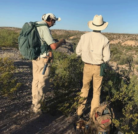
(Pictured at right are Bureau field geologists Daniel Koning (left) and Dr. Kevin Hobbs (right) mapping south of Socorro, NM. Bureau photo by Kristin Pearthree.)
“The addition of the 1:100,000-scale sheet is probably the most ambitious objective,” said Dr. J. Michael Timmons, Bureau Deputy Director and Director of the Mapping Program, “and it happens to overlap with some critical surface resource issues that are affecting the Jicarilla Apache Nation and adjacent communities.”
The standard STATEMAP funding supports geologic field mapping conducted by geologists and Geographic Information Systems specialists in the Bureau’s mapping program.
“Better understanding New Mexico’s groundwater basins has been a driving focus for the program since its inception in the modern STATEMAP era,” Timmons said. “Groundwater quantity, quality – for understanding contaminant transport and identifying naturally-occurring contaminant sources – and modes of recharge are largely driven by the geologic architecture of the region.”
This year’s mapping projects are focused on 7.5-minute quadrangles in the Rio Grande corridor and the Lower Pecos River watershed. An advisory committee identified these regions as important targets where geologic mapping can support the development of environmental policies, with a particular interest in managing groundwater resources.
The geologic mapping conducted in these basins supports aquifer mapping and groundwater modeling studies. These hydrogeology projects then support policy development, arming decision-makers with reliable scientific data needed to develop robust and responsible water management practices.
“Modern, detailed mapping is critical to understanding these groundwater systems,” Timmons said.
The supplemental funding will also support the development of a statewide surficial materials map and a web-accessible map of Bureau digital geologic maps available to the public.
“Moving forward, the web application will be able to show our users what maps are available in a standardized data model and what information is available during a project’s planning stage,” said Phil Miller, Bureau Coordinator of Map Production. “This is core to our mission and the way we share geologic information with the public.”
The STATEMAP program is funded by the United State Geological Survey’s National Cooperative Geologic Mapping Program with matching funds from the State of New Mexico.
– NMT –